Last Updated: 23 January 2014
Great Urswick
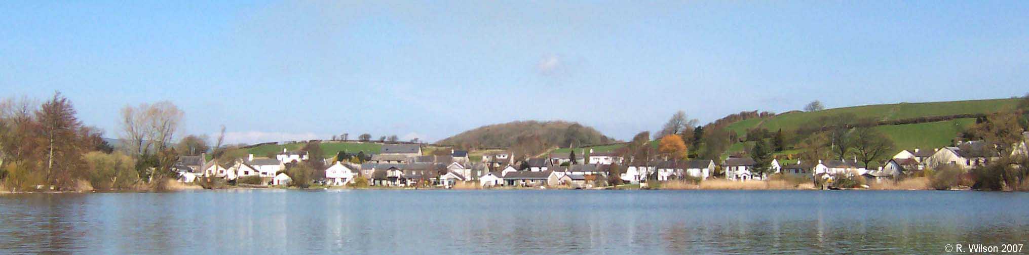
Great Urswick and Urswick Tarn looking to Daisy Hill and the village's former iconic sycamores
Great Urswick is an ancient village nestling beneath steeply rising ground to the north and east, where
within living memory its original ancient field patterns ascended the sloping ground
approximating to a radiating
fan from the settlement below. The village occupies three sides of a
rare 5.63 hectare marl tarn, the heritage
bequeathed to the village by glacial action. The
possibility of cavern collapses in the limestone below the
tarn can not be ruled out as a reason contributing to its presence.
The water entering the tarn is from a limestone catchment
and most rises from springs at its bottom. As a marl tarn it has
taken on an importance in modern times as a site for ecological and
scientific research. Within the settlement, regard for the tarn is, for most, based on its
undoubted visual amenity. It is also valued as a
location for course fishing and bird watching. But its
real importance linking it to the initial establishment of a
settlement was the provision of a dependable supply of
water, water both for the inhabitants of the settlement and,
importantly, their livestock. It was not until around
1900 that mains water came to the village sourced from high
ground on the nearby Furness Fells where the catchment is over
a different geology which then ensured soft water being delivered to a parish
which up to that time had been accustomed to hard water from
its local limestone catchment.
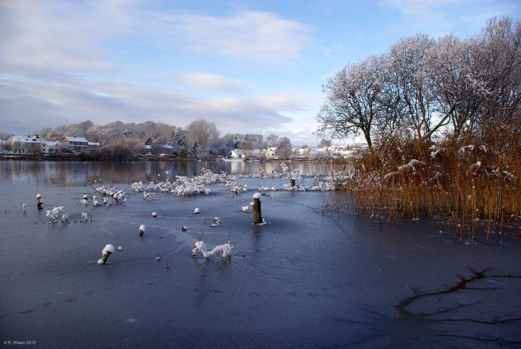
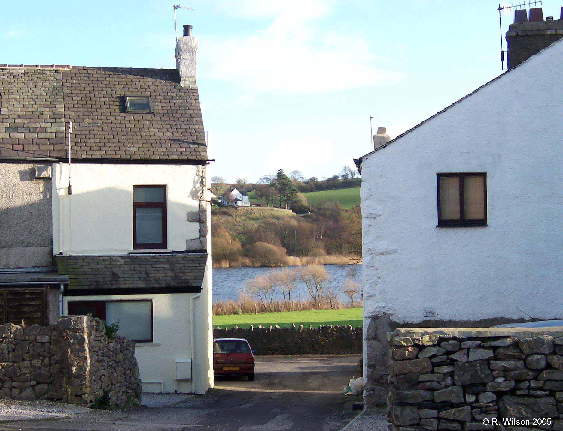
Urswick Tarn and the west side of Great Urswick in winter.
It is important to recognise that a marl tarn must be
given regard not only as the body of water
which is readily seen, but in combination with the marl
bench which the body of water has created all around its
perimeter. In the case of this marl tarn the marl
bench is well developed and has been long in the making.
However, it is to be
greatly regretted that it
has been used as a depository for material which is alien to
a marl bench for such a long time that it is now grown over
by vegetation which disguises its presence and hence creates
an illusion that it is the water alone that is significant.
More seriously, the disguised margin risks creating a
mistaken impression of a load bearing capacity which is beyond that of
the marl below. Coring has shown that the marl is of
significant depth, buried below the beguiling vegetation which covers
the bench. No other tarn of this type is known to have
buildings constructed, or proposed for construction, over
marl in close proximity to the body of water which still
keeps the marl saturated and paste-like.
It would be inappropriate for such a marl bench to be
included within a boundary
where development was approved by a planning authority
without that authority having established beyond doubt that
the ground is fit for purpose.
At the parish level, Urswick Parish Council is well informed
regarding these concerns and as owners of the tarn on behalf
of parishioners, are in a position to contribute an appropriate precautionary responsibility. There is a separate section of this site which deals with
Urswick Tarn in more detail (Click).
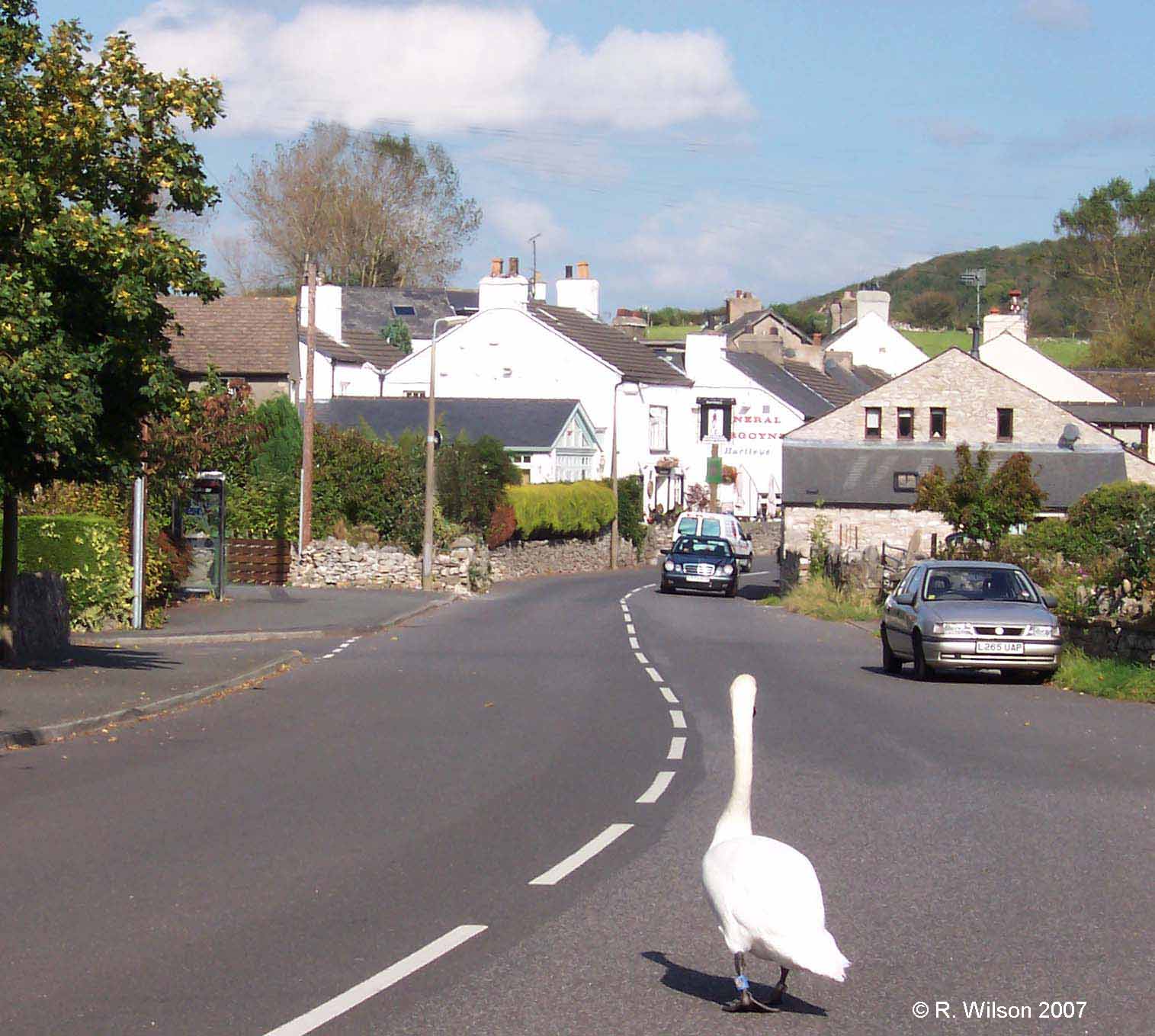
Not its normal route to the tarn
Whilst still being small, with around 230 dwellings, the
village is the largest settlement in the parish. It has two
pubs and Low
Furness Church of England Primary School, although the
latter, based on ancient village boundaries, is historically
located in Little Urswick. Distal county authorities
with responsibility for road signs can easily distort
perceptions on such things as boundaries when local population
movement is so dynamic and is without historic awareness to
be in a position to question
inaccurate signage. For two half days each week the former fine old
village Sunday School serves as a base for a mobile Post
Office and some retailing activity. There is no longer
a
scheduled bus service through the village but the children
of Low Furness are taken by bus to their respective schools either
in Urswick, Ulverston or Dalton in Furness. Despite
the provision of this transport service to the schools, a large number of private
vehicles remain involved each day in the delivery and
collection of children.
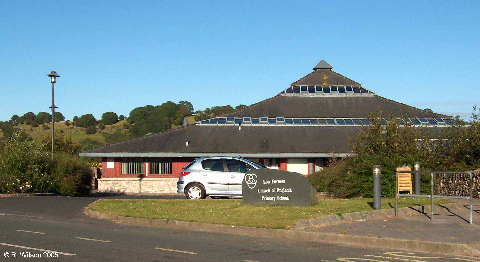
Low Furness Church of England Primary School
Low Furness Church of England Primary School is located between the two villages of Great Urswick and Little
Urswick and was opened in 1994. As implied by its name, it serves an area of rural Low Furness beyond
the Parish of Urswick. When its pupils reach the age of eleven
the majority transfer to
Ulverston Victoria High School, four miles away in the market town of Ulverston.
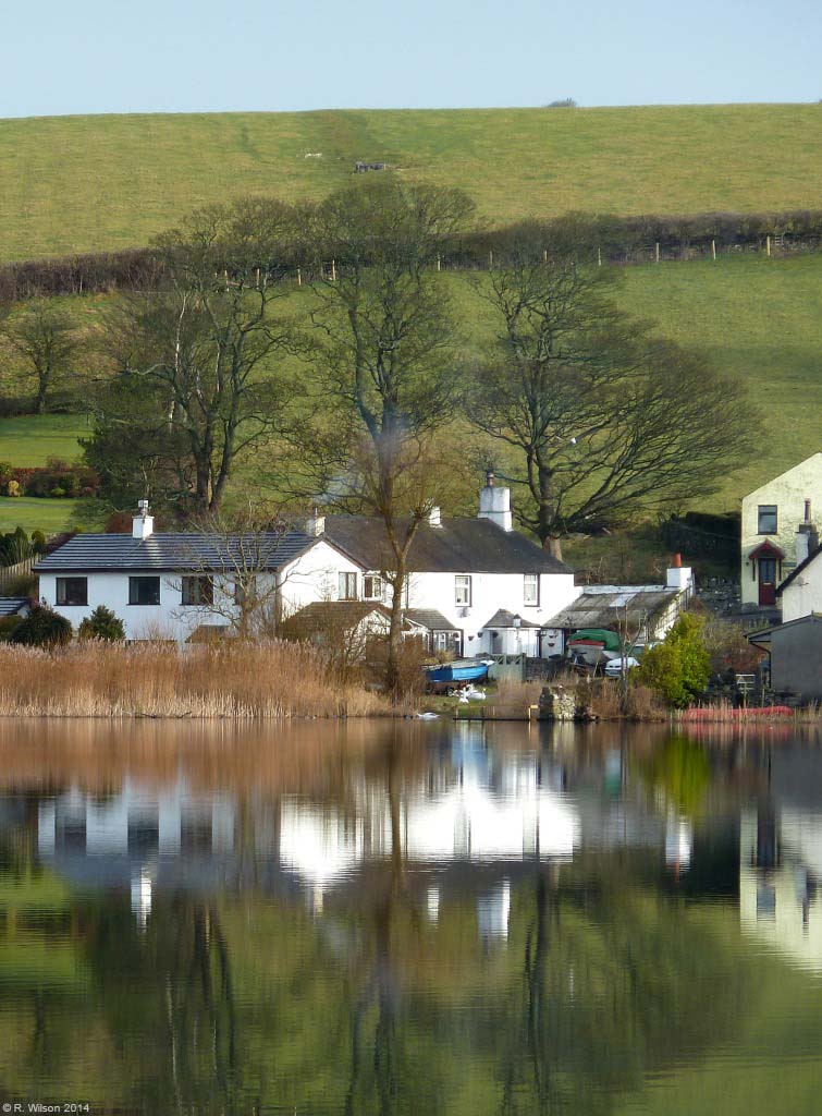
Looking east from Brow End
The only employment in the village, apart from the domestic help which will be availed of by some families, is associated with local tradesmen and is at a low level. The most important centres for employment for the village inhabitants are Barrow in Furness to the south and Ulverston. Agriculture is still important across the parish but employment levels are now low. During the second half of the nineteenth century the very large scale haematite mining around Lindal in Furness brought a significant source of employment to the men of the two Urswick villages. The many footpaths around the parish were their means of getting to and from work. A tin bath in front of the fire filled with water carried from the nearest well would be their means of cleaning up after their dirty wet days in the glutinous red iron residues of the mines. These residues have stained some local areas of land, and in wet weather some roads still flow with red run-off water.
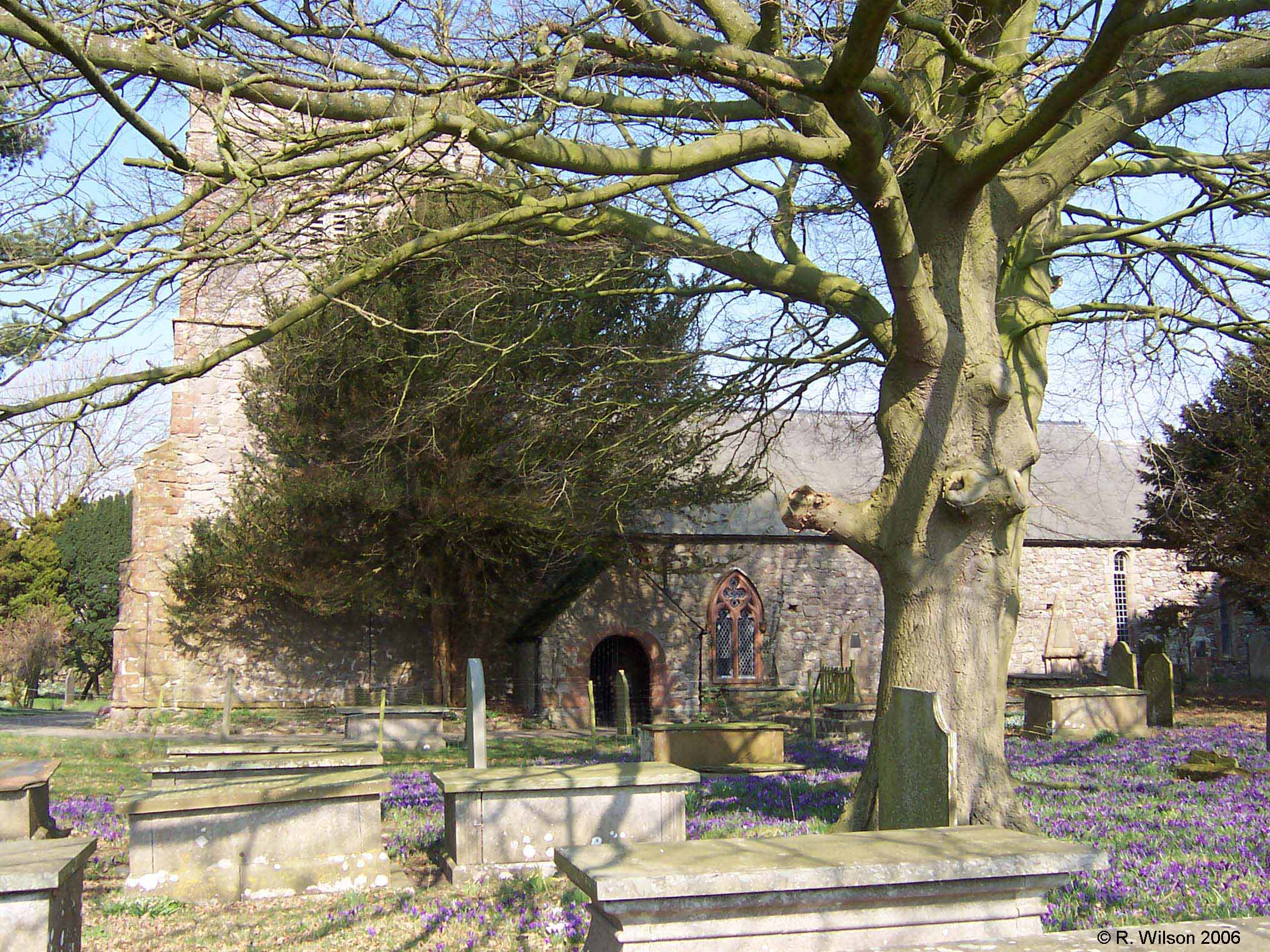
Urswick Parish Church of St Mary and St Michael
The parish church of St. Mary and St. Michael is believed to
have its origins as far back as the 7th or 8th Century and therefore
pre-dates the rich and hugely influential Cistercian Furness Abbey,
5.6 km to the southwest, by a considerable margin. The
abbey has been in ruins since the reformation. The structure
of the parish church has been upgraded many times over the ages, but
its great age touches the senses of all who visit this centre of
spirituality to the countless generations of Urswick residents who
worshipped here over the millennia. The annual carpet of
crocuses in the churchyard is a sure telegraph of approaching Spring
and its ancient sundial an icon of life's passage.